

Navionics Platinum+ Large Chart NPEU643L
Manufacturer

- SKU:
- 598124
Choose a variant and enter the desired quantity
Manufacturer
Description
Navionics Platinum+ Large Chart NPEU643L
Navionics Platinum+ Large NPEU643L is a premium electronic chart for compatible plotters, providing detailed cartography for the Mediterranean Sea, the Black Sea, major rivers and over 42.000 lakes worldwide. Chart data comes from official, governmental and private sources, and is continuously updated for precise and safe navigation.
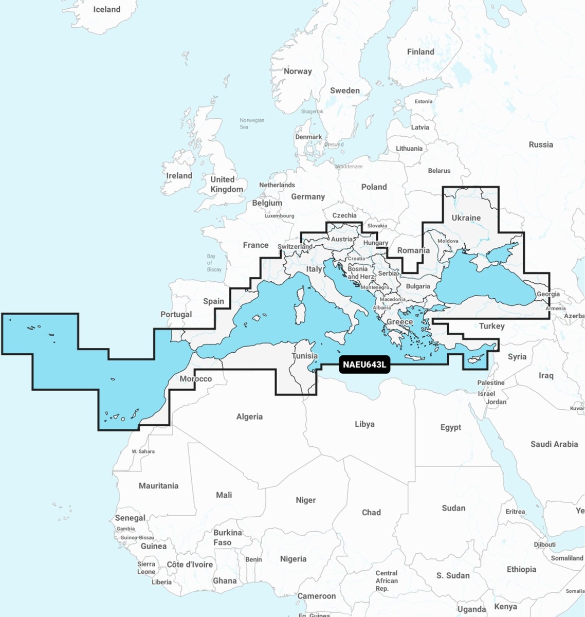
The card is delivered in microSD format and includes a one-year subscription, providing access to daily chart updates and advanced features such as Relief Shading, SonarChart™ HD Bathymetry, Dock-to-Dock guidance, 3D view, satellite imagery, aerial photos, Plotter Sync and SonarChart Live. Coverage includes the Mediterranean Sea, the Black Sea, the Danube up to Passau (Germany), the Sea of Azov, the Bosporus, the Dardanelles, as well as numerous important ports and lakes across Europe.
Features:
- Type: Navionics Platinum+ electronic chart;
- Region code: NPEU643L;
- Format: microSD card;
- Coverage: Mediterranean Sea and Black Sea;
- Includes cartography for oceans, seas, rivers and over 42.000 lakes;
- Relief Shading for detailed representation of underwater relief;
- SonarChart™ HD Bathymetry with contour lines down to 0.5m;
- Satellite imagery with SonarChart™ Shading overlay;
- Dynamic 3D view;
- Aerial photos for ports, marinas and navigation landmarks;
- Community Edits with information provided by Navionics users;
- Automatic Dock-to-Dock Route Guidance;
- SonarChart Live for creating bathymetric charts in real time;
- Advanced map customization options;
- Plotter Sync for wireless synchronization with the Navionics Boating app;
- Includes a 1-year subscription for updates and premium features.
General product rating

 Like review
()
LOADING
Like review
()
LOADING
Questions and answers
Question:
Automatically translated from Romanian
Answer:
Automatically translated from Romanian